How to easily create and customise
your mappr
Our teams will assist you during the various stages of creating your interactive map Contact the Mappr team!
1 - Design your Interactive map
Create a dynamic map in your colours and based on your project.
Click on the blue points for more information
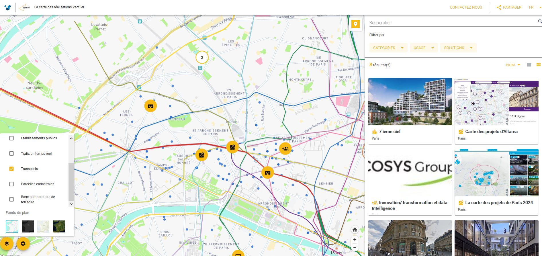
1
You can choose within more than 30 maps template
2
Choose the pictograms in our libraries or in your graphic charts
3
The dynamic list of points of interest is displayed by list or thumbnail
4
Customize the location of the search engine and filters
5
Integrate your logo and your corporate design.
6
Integrate GIS Data, Open data, Big Data ….
2 - Create your own data sheets
Customize the content associated with the points on your map.
Click on the blue points for more information
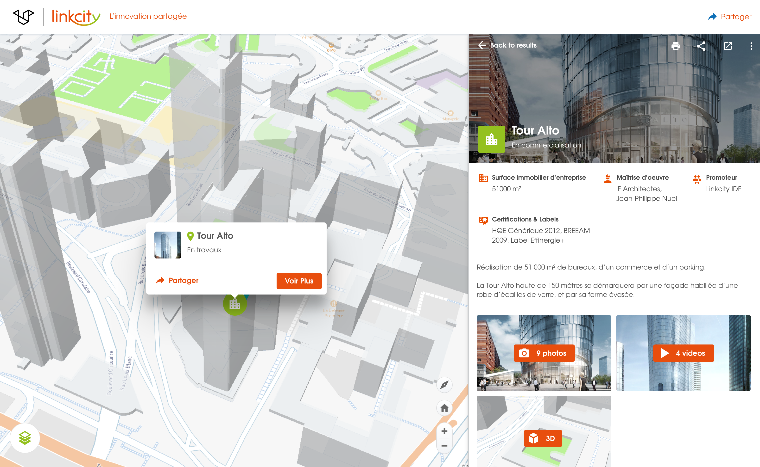
1
Build the miniature and define its behaviour: when clicking, hovering…
2
Pair an image with your point of interest
3
Define categories and pair associate them with icons from our libraries
4
Integrate any text content
5
Create image galleries
6
Create video galleries
7
Integrate any content hosted on the Internet into Iframe: 3D model, website, connected camera…
8
Print, share or visualise your files full-screen
3- Integrate and index your data
Make use of our powerful full-text search engine
Click on the blue points for more information
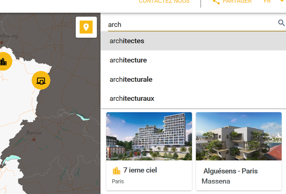
1
Easily search all information within your database
2
Benefit from search suggestions
3
Share results by creating a personalised map
A project?
Contact us if you want to talk about it.
Sign up
to our newletter!